East End Park has a mythical quality about it. Where was it? When was it? Are you sure that it was in Memphis? Was there a roller coaster, or are we confusing that with the Zippin Pippin at Liberty Land?
Let's take a trek back, over a hundred years ago, to this happy place called East End Park, and find out.
Because long before there was the Prairie/Turner Dairy, there was East End Park.
Long before 18-wheelers rumbled around the Blue Monkey from Madison on to Morrison, trolley cars cling-clanged past and made stops at this corner, just feet from Overton Square.
 |
| Then & Now of Madison, 1912 to today. Two views looking east down Madison. What is now Molly’s La Casitas and the Blue Monkey was in 1912 a new building housing a meat market and Walker’s Bakery. Next door to the east was East End Park’s “Writing Station,” welcoming park revelers, and a trolley car of the “Dummy Line.” 1912 picture courtesy multiple sources. Today picture taken by author last week (11/7/16) |
In light of proposed (and now halted) expansions to this historic piece of real estate, I have rushed this story into production, piecing it together from a variety of sources that I reference at the end* and.** Therefore, this post is a work in progress - remember that! - as I was saving it for later on “down the road” on the Madison Ave project. But I believe an understanding of our past is critical - an understanding that shapes our present and our future.
 |
| A photo of the pavilion and the lake at East End Park. Writing at the base of the photo: "North side Madison bet Morrison and Diana" and "1895." Memphis Public Library, Frierson, S. |
 |
| Three men & three women riding the miniature train. 1910’s Memphis Public Library, Gift of Pink Palance 1976 |
 |
| Meet Mr. Howard Chapman Boaz and his wife Lena. When this picture was taken in 1912 they were living at 2043 Union Ave, at Diana Street, just a block away from the park. Courtesy of the Memphis Public Library and the Joe Bennett Collection |
"Vance" of Memphis Magazine’s “Ask Vance” column called East End Park “our city’s first amusement park” that was touted as “the Coney Island of the Mid-South.” Developed before the turn of the century, it preceded Overton Park and the Zoo by a few years. It came before there were the Fair Grounds. It was generations ahead of Liberty Land. And it arrived at a time in the early 1890s when Memphis was enjoying historic growth, and in full recovery from deadly bouts with the yellow fever that wiped out scores of families rich and poor in the twenty-plus years that followed the Civil War.
At the peak of its existence between the mid-1890s thru the 1910s, citizens from a quickly-growing Memphis area could walk, bike (yes, bike), or take the Dummy Line trolley - later many would drive their new motor-cars - to East End Park and enjoy a lake, a dance hall, arcade games, a beer garden, and yes, a roller coaster. A pine-wooded roller coaster, the coaster that would become Elvis’ favorite ride, the Zippin Pippin. And for a short time park patrons could even enjoy vaudeville acts.
 |
| Inset of the Williamson Map 1891 tells us the location of East End Park. Madison runs left to right (west to east) and it turns south to Cooper at the familiar curve in Overton Square. Stratton Ave, seen toward the bottom of the inset, was later renamed Morrison Ave. Courtesy Shelby County Archives |
But for you purists, where exactly was it located? East End Park sat on 50 acres of land north of Madison Avenue, on the eastern end of the town of Idlewild before it was annexed by Memphis. The street that is now Morrison ended at Madison at the park - the building that now houses the Blue Monkey would be built just adjacent to park grounds in 1912, at its western edge. Its eastern edge ran parallel to Lick Creek and right about along the fence that separates today’s dairy property with the Bayou Bar & Grill parking lot. And its northern edge did not stop where Jefferson Manor Apartments are now - it was all the way up at Poplar Avenue, at the foot of what was still Lea’s Woods before that land became Overton Park.
 |
| A screen-shot of a 1907 Sanborn map. I rotated the image so that north is up. Madison Ave runs along the bottom of the picture. From here we can see quite a few details, including the Madison Ave writing station (bottom left), the lake, the roller coaster (bottom), and the park's arcades and other "amusements" to the west (at left). Courtesy Memphis Public Library |
Author Paul R. Coppock’s books - a treasure trove of Memphis history - describe the park area in the 1880s as a plot of farmland where hunters hunted and fisherman fished in the Lenox Bayou. As visitors increased a small dam was added to form a lake, picnic tables were added, and then in the later months of 1889 the amusements of East End Park were built by the East End Railway Company as a destination for riders of their trolley - the East End Dummy Line - which had been completed in 1887.
The Dummy Line ran along Madison Avenue and connected Downtown streetcars with the emerging towns of Madison Heights and Idlewild to the east (Memphis’ eastern city limit up until 1890 was at Dunlap, now the Medical District). It made the familiar right turn to the south at the corner of Madison and Cooper, continued down Cooper, and made a left turn at Young Avenue where it took riders to the horse races at Montgomery Park, at the site of today’s Fair Grounds and Mid-South Coliseum.
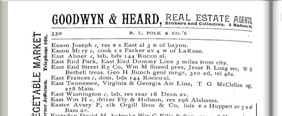 |
| For the first 10+ years of its existence after 1889 a physical address wasn’t listed in the city directories, listed only as “East End Park, East End Dummy Line, 3 miles from city,” or “East End Park, Madison av opp. Stratton” (later renamed Morrison) |
Mr. Coppock described rides on the Dummy Line trolleys as “prime entertainment.” There were parties on the cars, filled with the promise of alcohol once riders reached the beer garden of East End Park. There were also those revelers who stole rides on the trolleys, “big boys” who had to be thrown off by policemen and were sometimes arrested.
The park quickly grew. From Coppock’s book Mid-South: “A dance pavilion was put up. There was a beer garden. Eventually there was an entrance gate on Madison, a sawdust path between booths for canes, umbrellas, pennants, candy, the usual knickknacks, and the hopeless ring-tossing ‘games’ for prizes of dolls and pocket knives.”
Later a Ferris wheel and merry-go-around went up (complete with the sounds of a calliope but with immobile horses that did not move up and down). Vaudeville acts that performed at the Orpheum performed here during the summer. Finally, various sources indicate that the pine-wood roller coaster was built in either 1912, ’15 or ’17. However, a closer look at the photograph below tells us that in 1912 the wooden roller coaster had already been built.
 |
| Look closely through the partitions of the writing station just left of center and one can make out the lattice-like work of wooden supports for the East End Park roller coaster. Photo dated 1912. |
 |
| Two men & two women in car #7 of the Figure Eight coaster ride in East End Park. 1910’s, Memphis Public Library, Gift of Pink Palace, 1976 |
To further the when-was-the-coaster-built controversy, a glance at the 1907 Sanborn map earlier in the article reminds us that there was some roller coaster in the park prior to 1912.
The End of East End
The End of East End
In 1920 came this little thing called Prohibition, making liquor sales illegal, putting an end to the beer garden and taking the fun out of Vaudeville acts and the revelry out of the trolley revelers. Then, in 1923 a fire destroyed the park’s pavilion, and the park shut down. The pine wood roller coaster was dismantled, and was re-assembled a mile or so south at what is now the Fair Grounds, where it became simply the "Pippin." Years later, with the development of Liberty Land, the Pippin would be "Zippin!"
After 1923 the parkland to the north at Poplar was sold off and subdivided into what is now the Belleair Neighborhood. Jefferson Avenue was extended east through the parkland, and Stratton was renamed Morrison (after Anderson B. Morrison, who managed the old Majestic Theater on South Main, the Orpheum, and East End's Summer Theater) and the street was extended north through Madison. What remained of the park sat at that north end of the property at Jefferson; a new dairy occupied the property on Madison after 1927.
 |
| Sanborn map, 1927. No more roller coaster, no more carousel. Courtesy Memphis Public Library |
City directory listings for East End Park disappeared from 1924 to ’26, and again from 1932 to ’35, but East End Park didn’t die easily. From 1927 to ’31 there were listings for either an East End Park or an East End Gardens. And in 1936 the East End Amusement Co. was formed and on the north part of the property this group built a dancehall at East End Gardens, and later the East End Skating Rink and East End Swimming Pool.
This part of the park would last until around 1941 - the skating rink and swimming pool would drop off the directories after 1941 - but the dancehall would remain in use into the 1950s.
The Dairy
In 1927 and ’28 the Forest Hill Dairy was built.
 |
| The Dairy, then and now. The picture above comes from a 1942 souvenir guide produced by the dairy. The picture was taken by the author in July. 1942 image courtesy of Dave French and Historic-Memphis website |
The dairy served local customers, good ol’ fashioned milk men delivering milk in the early morning hours in small trucks and returning to the dairy to hand-write their orders for the next day. Pure Americana.
 |
 |
| Both images from a Vintage Souvenir Booklet of the Dairy - 1942, courtesy of Dave French and Historic-Memphis website |
The dance hall that has stood since the mid-1920s would be altered somewhat in 1954 and taken over by the Memphis Jewish Community Center (seen in the map below). In the 1950s the dairy would be operated by Swift Co. Ice Cream, when it would begin the first of at least three more expansions.**
 |
| Originally nowhere near the size nor capacity it is now, the old dairy sat directly in between its neighbors, the Swift Co. Ice Cream Factory to the west and a small auto body shop to the east. 1954 Sanborn maps, Memphis Public Library |
Between the late 50s and through 2011 dairy ownership would eventually buy out its neighbor’s properties to the east, west, and north, including the building that housed the old Jewish Community Center. That property would for a few years house the Backstreet Night Club.
Today there is virtual no sign that there was once a place called East End Park. No pillars or pylons remain, and no markers yet exist. The sounds of revelers and the laughter of children have long ago died off. And the rumbles of a roller coaster now long-gone have been replaced with the rumbles of 18-wheelers at all hours of the night.
But still the myth of East End Park lives on.
But still the myth of East End Park lives on.
*I pieced together this draft from a variety of sources: from a couple of websites, Commercial Appeal archives, the Memphis Public Library and their digital collection, “Ask Vance” articles in Memphis City Magazine, and from the invaluable Memphis and Mid-South books of Paul R. Coppock.
**Josh Whitehead’s creme-de-memph blog post on the Forest Hill/Turner Dairy. For more reading on the dairy’s developments, take a look at his 2015 post:
http://cremedememph.blogspot.com/2015/01/forest-hill-dairy.html
Zippin Pippin was name given to the ride when it became part of Libertyland. Is was just known as the Pippin during the time is was located at the old Fairgrounds Amusment park
ReplyDeleteThank you for the clarification - I'll make an edit. This kind of in-depth information is hard to come by. And thanks for reading!
Delete